Have your say on the city centre proposals by 16th April. Please take a little time to do so, to make sure the cycling voice is heard.
It is proposed to divide the city centre into traffic cells. This is something Push Bikes supports. It stops people from using the city centre as a through-route, but it doesn't stop people from accessing the city centre by car. Accessing the city centre by car is absolutely fine, but only when it is absolutely necessary. If we want to see a reduction in car use, it is essential to reduce the need to access the city centre by car. Unfortunately the city appears to be pinning all its hopes on public transport, particularly the tram, a transport system that covers very little of the city but which creates a lot of barriers. Trains have the advantage of being fast, but the coverage is only slightly greater than the tram. So that means the city council must rely heavily on Sprint and buses, which creates a problem in the city centre, especially for a form of transport that provides 100% coverage, but which the city council is largely ignoring in the city centre. Care to guess what that form of transport is?
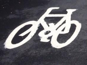
Back in May 2015, Push Bikes member Lea wrote an article entitled A Bit of Paint on the Road is Not Cycle Infrastructure. It described how painting cycle symbols on the carriageway did not make cycling through Edgbaston any more pleasant or safe. Has there been some sea-change in the relationship between motor vehicles and cycles that makes this method of creating a cycle route any more effective? Do I hear a chorus of NO!?
Back here in 2021, a couple of weeks ago, I was in Digbeth on my Brompton doing some food shopping, when I recalled that I had responded to a design for a pop-up lane between the A34 cycleway and Digbeth, effectively connecting with the A38 cycleway. It made use of wands, as has been done elsewhere in Birmingham to create pop-up cycleways. There were concerns raised over the rather complex design of parts of it, and it was suggested it would be better to go via Smallbrook Queensway rather than Digbeth and Edgbaston Street, but in general we were supportive of creating the much needed link. So I took a detour, just to take a look at what had been built in the end. I knew I would be joining it part way along, but I thought by Moor Street Station I should have found it. So I was deeply puzzled and hugely stressed to find myself surrounded by dozens of buses and several speeding taxis, with no sign of any cycling provision. I felt sorry for the bus driver who patiently crawled up the hill behind me, but I had no way of communicating that it wasn't my stupid idea to encourage cyclists to ride in a heavily used bus lane. By The Priory Queensway I was uttering curses about a game of soldiers, and decided that maybe my best bet was to head for the A34 cycleway and try finding the cycle route from the other direction. Part way along The Priory Queensway I gave up the unequal struggle with buses, and started riding on the pavement. When people do that, it's a sure sign that the local authority has failed to facilitate cycling.
Eventually I got to the blue A34 cycleway, and turned around, cycling down Dalton Street. In doing so, I discovered the dreaded cycle symbol approach to design that Lea complained about. On these quieter streets it was relatively easy to follow the trail of breadcrumbs, though it took a few guesses on my part. However, on the outbound journey it was hardly surprising I couldn't see them heading along Moor Street Queensway and down Albert Street because they were covered in the buses I was trying not to get run over by. Of course at the end of Albert Street I was then expected to switch to the right-hand lane and traverse a massive junction, and then work my way back up the hill on Moor Street Queensway. I then had to switch to the right-hand lane again, this time to pass under the Bullring. Now I know the vehicular cycling lobby think it's well within the ability of a human to accelerate their bike to 20mph to keep up with the traffic, but if it isn't blindingly obvious I can tell you that uphill on a Brompton heavily laden with shopping that is simply the most moronic of ideas.
As I passed through the tunnel under the Bullring I could hear the amplified roar of yet another bus, approaching me from behind, and I hoped that my rear bike light would help the driver to spot me in the gloom and overtake safely. Fortunately (s)he did, so my life was only shortened by having to breath in a tunnel full of diesel fumes, rather than ended abruptly. Then it was back down the hill along the section of Smallbrook Queensway where the council couldn't be bothered with clear lane demarcation for motorists, let alone cyclists. Finally, at the junction of NCN5 I came across the only sensible piece of infrastructure on the entire route. It is now legal for a cycle to turn left on to the cycleway. How many decades has it taken for the council to put up that sign? I didn't stop to take a photo, and it seemed even more pointless photographing cycle symbols. So the photo above wasn't even taken in Birmingham, but does that matter given that there would be nothing more to see if I had taken the photo on Moor Street Queensway? And in any case I would probably have been pancaked by a bus had I tried.
This link route is dismal, and a complete waste of money. For want of something better I've ridden it before it was made official, and I didn't enjoy it then. But now it is even more bus-centric and even less cyclable, and the cycle symbol breadcrumbs have no impact on that whatsoever. The Queensways (the old inner ring road) are massively wide, yet BCC found itself unable to find space for a few wands when it was implementing the changes to these roads. I'm disgusted by the utter disregard for vulnerable road users that this route represents.


