David wrote recently about the emergency transport plan measures taken by Birmingham City Council. There are consultations open for these, and I would urge you to respond to them, because otherwise all the city council will see are the knee-jerk "bikelash" responses. Some of the schemes are more successful than others, but even if you think a scheme is not so great, describing what would be make the scheme work for you is far, far better than silence.
Two types of measures have been taken, namely pop-up cycle lanes and low traffic neighbourhoods. In this article I've linked to the consultations, and given you my own view of those with which I'm familiar. Lisa Jones from Cycle Birmingham has ridden more of the pop-up lanes than I have, and reviewed them.
Pop-Up Cycle Lanes

- A38 Pop-Up Cycle Lane consultation closes 28th February
- A45 Pop-Up Cycle Lane consultation closes 21st February
- A47 Pop-Up Cycle Lane consultation closes 10th June
- Bradford Street Pop-Up Cycle Lane consultation closes 3rd June
- City Centre to City Hospital Pop-Up Cycle Lane consultation closes 24th March
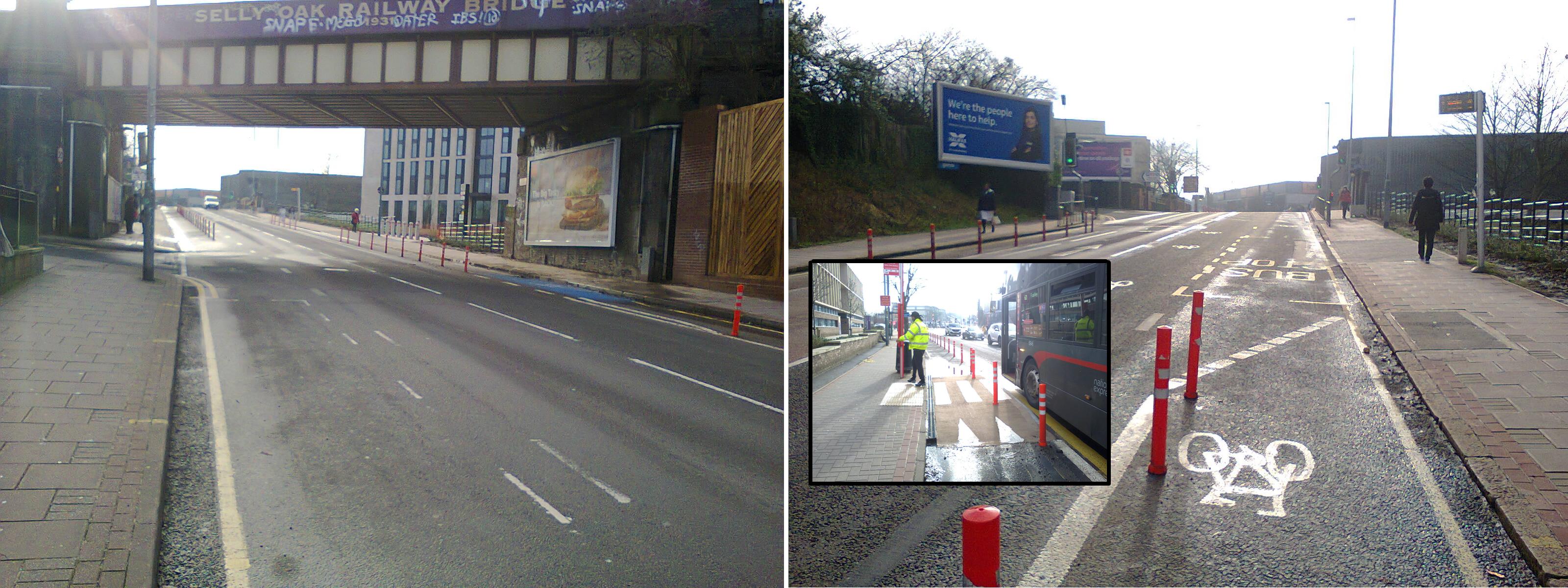
Lisa Jones from Cycle Birmingham (the Push Bikes social group) has written a review of a number of these routes. I've only had reason to cycle one of them, namely the A38 pop-up lane. This is in two parts, with one section along Bournbrook High Street (Lisa Jones' photo right) and one section between Selly Oak and Northfield (photo below). The two are supposed to be connected by a short length of permanent protected cycle lane on the Selly Oak Triangle junction, but that is not yet complete.
Bournbrook High Street has long been horrible for people walking and cycling, and badly needs taming. Sadly the pop-up cycle lane does nothing to tame the motor traffic, and creates a series of obstacles for cyclists that make it very awkward to use. The northern end of the lane starts at Grange Road, where south-bound cyclists almost immediately have to give way to motorists using a small gated car park off Grange Road (photo below). Then at Dale Road one is supposed to go via a pavement crowded with pedestrians, in order to push your bike across the pedestrian crossing. This is slow and awkward for able-bodied cyclists, and could be impossible for people using a bike as a mobility aid. It's also very unpleasant for pedestrians. Towards the Selly Oak end south-bound cyclists are somehow supposed to cross the road, but it is totally unclear where one is supposed to do this. Despite the width of the road, the lane is very narrow; too narrow for two people to pass comfortably in the two-way section. The narrowness has been exacerbated by placing the wands in the cycle lane, not along the white line. I have tried going south-bound using Dale Road instead of Grange Road, but whilst this works better, squeezing between bikes on my right and heavy motor traffic on my left just makes it slow and nerve-wracking, so I quickly gave up using the lane going south-bound. I do use the lane going north-bound, though I rejoin the motor traffic to cross the crossroads at Dale Road (as is the intention).
The problems going south-bound continue in Selly Oak. Having crossed the road once, cyclists are supposed to cross the road again at Chapel Lane. A diagonal crossing is provided, but the wait is lengthy. On the other side there is a new section of proper protected cycleway. Alas it currently ends in construction barriers at Harborne Lane. It is intended that the cycle route continues a little further, but after waiting for the lights at Harborne Lane one is expected to cross back at Frederick Road, using a two-stage toucan crossing. It is all hopelessly slow and convoluted, and a demonstration of how encourage people to drive rather than cycle. On the other side of the road between Chapel Lane and Harborne Lane is unreformed motor city, with space found for three lanes of motor traffic. To be honest, I prefer that to the cycling infrastructure. I raised objections to the number of motor traffic lanes during the consultation, but those objections were dismissed.
Between Selly Oak and Northfield cyclists use the new bus lanes. The original cycle lane has been left in place, something I suggested because removing it would have cost money for no benefit, whilst left in place it acts as a visual aid for bus and taxi drivers. As a temporary measure this works well, though it would be a poor permanent solution. Firstly the junctions are nerve-wracking, because there is a high risk of being left-hooked. The speed limit has been reduced to 30mph, but too many drivers still see the A38 as a race track. Secondly, the lane is shared with private hire drivers, and the paint doesn't improve their driving standards. Finally, some drivers use the lane illegally to undertake. I've seen near-misses when two or more drivers near simultaneously decided that switching to the left-hand lane might be a good way to shave a few seconds off their journey, and it was very unnerving to experience an undertaking driver swerving around me whilst I was cycling in the cycle lane.
Near the orthopaedic hospital the south-bound route joins the pavement, giving way wherever motor traffic crosses it. As cycling infrastructure goes it's as poor as it's always been, but less nerve-wracking than the bus lane, and way preferable to joining in with the street car racing. There is a huge amount of space here to build a proper cycleway, as was done on the A38 further north.
Suggested Improvements
- Remove the give-way to the car park in Grange Road. If felt necessary, paint the cycle lane blue at this point.
- Take the wands right up to the crossroads by Aldi, and let cyclists cross in both directions on the Dale Road pedestrian phase (it would be sensible to provide repeater lights for cyclists).
- Move the wands on to the white line. Ideally the entire lane should be widened (there are still three lanes of motor traffic being maintained on the high street, which is ridiculous, especially given that there are a further two lanes on Aston Webb Boulevard for through-traffic).
- Either extend the lane that leads up to The Dingle as far as the crossing by Aldi, or (better) extend the lane on the other side further towards Chapel Lane. It would be best if it went all the way to Chapel Lane, but it should go at least far enough that people heading south can cycle up to the crossing outside the station.
- Reduce the waiting times at the crossings in Selly Oak. I would suggest that if a button is pressed, then the crossing switches to the cycle/pedestrian phase(s) at the next phase. This would prioritise active travel. This is especially true of the Chapel Lane junction, where lots of capacity has been maintained for motor traffic, clinging on to the old ways that do not address the climate emergency declared by the council.
- Build a cycleway for south-bound cyclists along on the opposite side of the road from the new protected cycleway, so people on bikes don't have to keep crossing back and forth using the slow crossings. This would have the added advantage of creating cycle traffic on the same side of the road as the mostly unlet new shop units. It's been shown many times that passing active travellers bring trade, whilst passing cars do not.
Low Traffic Neighbourhoods
- Bournville, Castle Vale and Moseley consultation closes 22nd April
- Kings Heath consultation closes 22nd April
- Lozells consultation closes 19th April
A consultation on further measures in Bournville is available until 31st March.
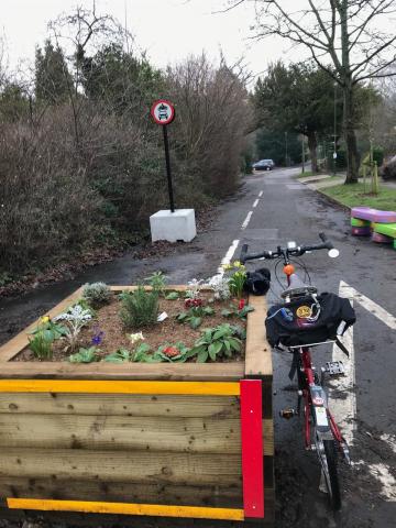
Of these I'm only personally familiar with the schemes in Bournville. I'm told the people that live on the quietened streets are increasingly positive about the schemes, as they discover the benefits of reduced noise and pollution, and increased personal safety. They have reclaimed the streets they live on, with people walking down the carriageway instead of being forced on to narrow pavements (Oak Tree Lane in particular has only a single narrow pavement that switches from one side of the road to the other), and children are playing in the street. When that happens, people start meeting each other and building communities.
From a personal perspective, whilst I greatly welcome these schemes, the impact on me is quite small. The Oak Tree Lane filter means I can now get to and from Bounrville Park without having to worry about drivers taking full advantage of the out-dated junction geometry on Oak Tree Lane. The header picture shows a woman with two children on bikes and a dog slowly wandering across this junction, and you can also see it being used by cyclists in the slide show at the top of our home page. Both schemes in Bournville eliminate crossroads, greatly reducing the points of conflict. In the case of Franklin Road, this opens up the possibility of a pedestrian crossing. I once tried getting to and from CoCoMAD crossing Linden Road at this point, but only once. The experience means I now go on a detour, so I would welcome a crossing here. I hope these schemes represent the start of something much better.
Suggested Improvments
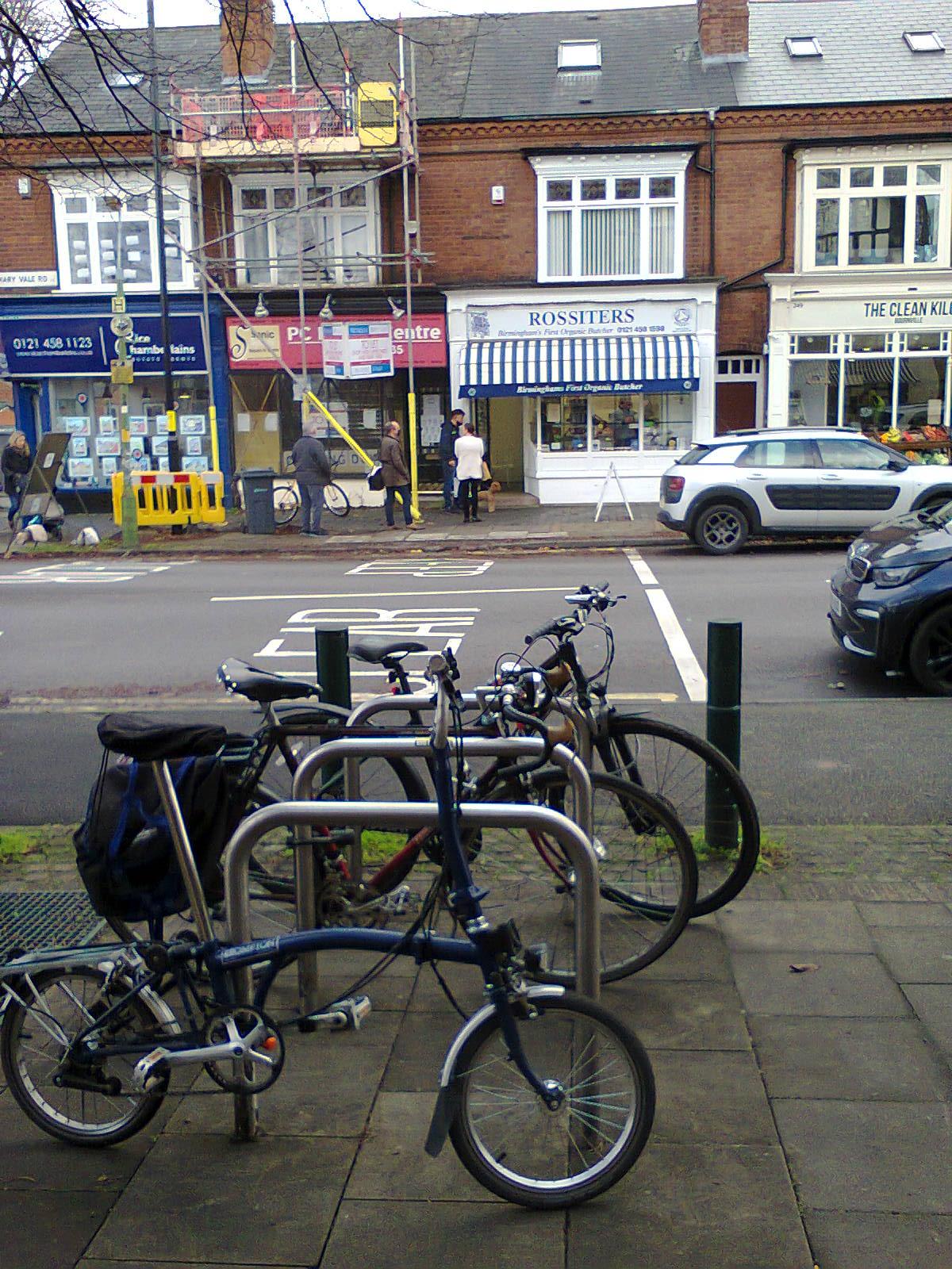
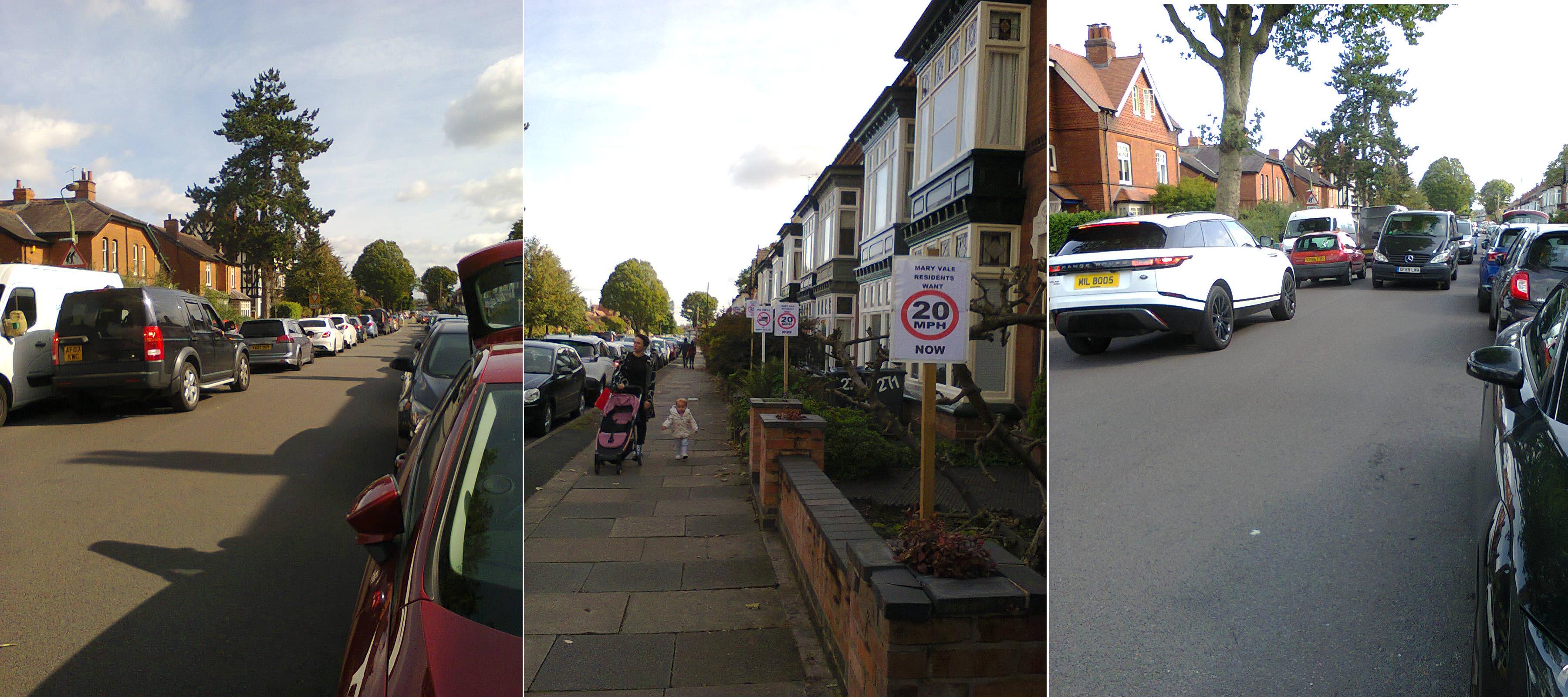
- With the help of traffic engineering input from Scott Cooper, I have suggested further LTN measures for reducing traffic on Mary Vale Road, where there are a number of shops that are popular with cyclists and pedestrians. The people on Mary Vale Road are clearly unhappy with the heavy and often fast-moving motor traffic (photo below), as am I. These measures have been passed on to the council for consideration under the second phase of funding, and are supported by Our Bournville. They also received a positive response from the local councillors.
- There's also scope for many more LTN measures, especially given that Bournville was designed to enable and encourage walking. For example, Oak Tree Lane could be closed to through motor traffic between Westholme Croft and Acorn Close.
Give Way to Gated Car Park

Pop-Up Cycle Lane at Dale Road
Where Am I Supposed to Cross?
Visualisation of Bournbrook High Street

A38 Pop-Up Cycle Lane

Mary Vale Road Traffic Protest
Suppressed Demand in Mary Vale Road
