Dudley Road Safari

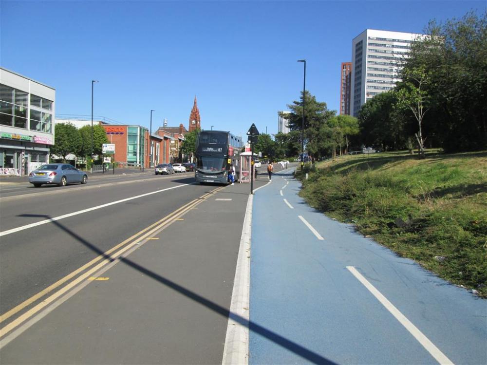
Bus Stop next to Dudley Road Cycleway

We first looked at the plans for Dudley Road back in 2020, and found the original plans to be very poor, feeding back our findings to Birmingham City Council. The plans were substantially improved. The project is now complete apart from the section outside the hospital. Despite being not quite complete, we decided it was time we took a look.

In my opinion that which has been built is very good except where the council has opted to use limited space for parking outside Dudley Road shops rather than cycling infrastructure, even though it is now well known that people using these parking places bring little trade but cause congestion. This has been done even though there is nearby on and off-street parking. On the other hand, creating substandard cycling infrastructure discourages people from cycling. Thus the council has built effectively discontinuous infrastructure that is contrary to best practice. That said, the two times I have been here the motor traffic was obnoxious, with lots of it and many boy racers. So what has been built will make the area less hostile for people who choose to walk and cycle, and mostly it is very good.

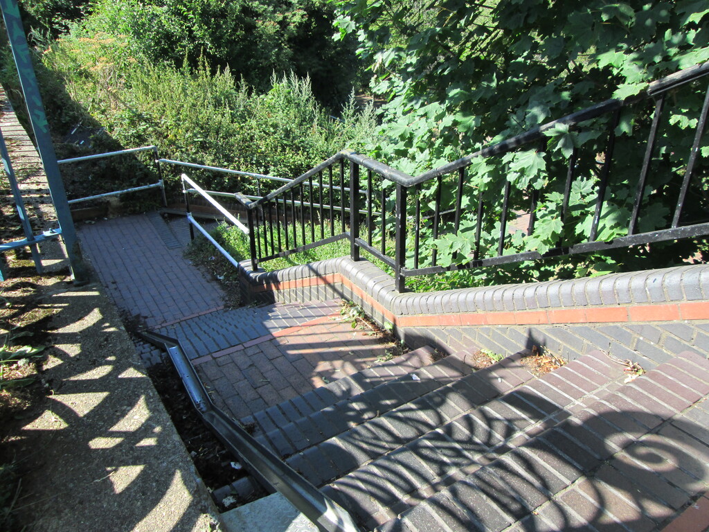
On both my trips to the area I followed the Worcester and Birmingham canal to the city centre, crossed the city centre via Granville Street and Sheepcote Street, and then followed the canal, On the first trip there I left the canal at Ladywood Middleway so I could join the Dudley Road cycleway at its start at Spring Hill roundabout, but the canal access at Ladywood Middleway necessitated carrying my bike up an unnecessarily steep flight of steps (there is a wheeling ramp, but it is too steep and tight to be usable). On the second trip I stayed on the towpath until I got to Clissold Street (see photos below). However, the fact that on the one hour cycle journey from my home to Winson Green Road I was almost entirely off the carriageway, and always away from fast and heavy traffic, is quite remarkable.

But let's not beat about the bush. Without the canals I would have been forced to make most of the journey on the carriageway, because Birmingham is making pitiful progress addressing the problems created by excessive private car usage. The three of us were there on yet another of the blistering hot days that anthropomorphic climate change is serving up for us. What has been built on the Dudley Road is way too little far too late, and each cycling infrastructure project undertaken by the council takes years. We got there on traditional pedal cycles (and I went twice). Thus our journeys were as close to zero-carbon as you can get short of walking. Not only did our respective journeys have a miniscule carbon footprint, but also cycle manufacture has a small carbon footprint, especially when you consider that the bike I used to get there is around forty years old. Far from being super-fit athletes in our prime, all three of us are over sixty, and one of us is over eighty (and he, like me, had a two hour journey in the hottest part of the day). When are we going to stop finding excuses for not building a transport network for zero-carbon transport? I am so tired of the worn out excuses for not addressing climate change, especially when the technology is available now to the vast majority of the population, if only we would build for it instead of feeding the insatiable demand for motorised transport.

Let's now dig into the detail of what has been built on the Dudley Road, starting at the Spring Hill roundabout

Tags: 

Bus Stop next to Dudley Road Cycleway

Bus Stop next to Dudley Road Cycleway
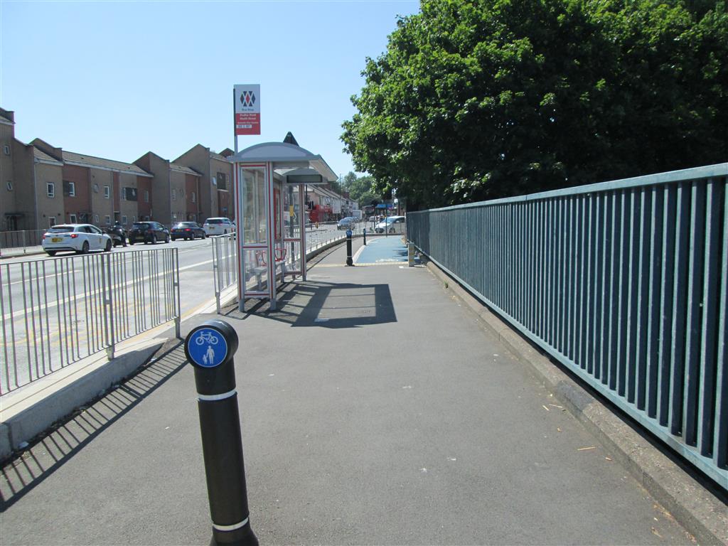
Looking towards Spring Hill roundabout, the cycleway runs behind the bus stop, so bus passengers and cycle users don't conflict. Alas as you can see, lack of maintenance means the cycleway is substantially overgrown, something that has happened in a number of places. Can you imagine any carriageway lane being left to become 50 % overgrown?

Tags: 

Dudley Road Cycleway Switching Sides

Dudley Road Cycleway Switching Sides
A short distance from the Spring Hill roundabout it looks like the cycleway continues on both sides, but the left-hand side only goes as far as the shops. To get to the roundabout it's necessary to cross here. However, the toucan crossing for this crosses all four lanes in one stage, and it's easy to make the turn into the crossing and have a good view of the motor traffic in both directions because the cycleway is behind the footpath on both sides. The delay at the crossing could be less, but it's not terrible.

Tags: 

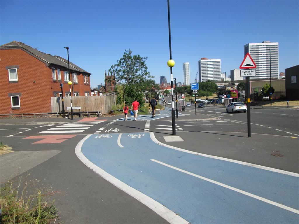
Side Road Crossing on Dudley Road

Side Road Crossing on Dudley Road
Where the Dudley Road cycleway crosses College Street, a minor side road, the carriageway is raised to give cycle users a smooth ride whilst drivers have to slow for a hump. The side-by-side crossing allows people to cross immediately if it is safe to do so, whilst drivers are expected to give way (and a driver did indeed give way to me as I approached this crossing). The crossing is set back from the Dudley Road (though not excessively so) to make the junction and crossing safer. The only possible criticism of the infrastructure is that ideally the visual treatment should be to make this not look like a carriageway at all, to make drivers feel uncomfortable about going this way. But hey Brummies, isn't it about time you learned to recognise a cycleway and expect cycles on it? On another part of this cycleway, I was one of two people who pinged a smartphone zombie before he moved to the footway (with a spoken apology, I should add).

Tags: 

Connecting Dudley Road Cycleway to the Canal
Connecting Dudley Road Cycleway to the Canal
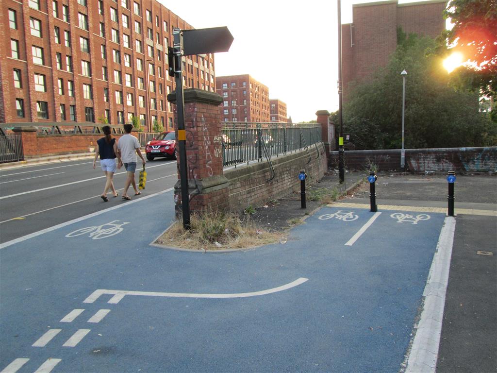
At this point a stub has been built to connect Dudley Road to the canal towpath. From this point one can get to the north side of the city centre on the pop-up route (pushbikes.org.uk/blog/consultation-city-centre-a457-dudley-road-cycle-route), or follow the canal towpath in the opposite direction to Brindleyplace.

Tags: 

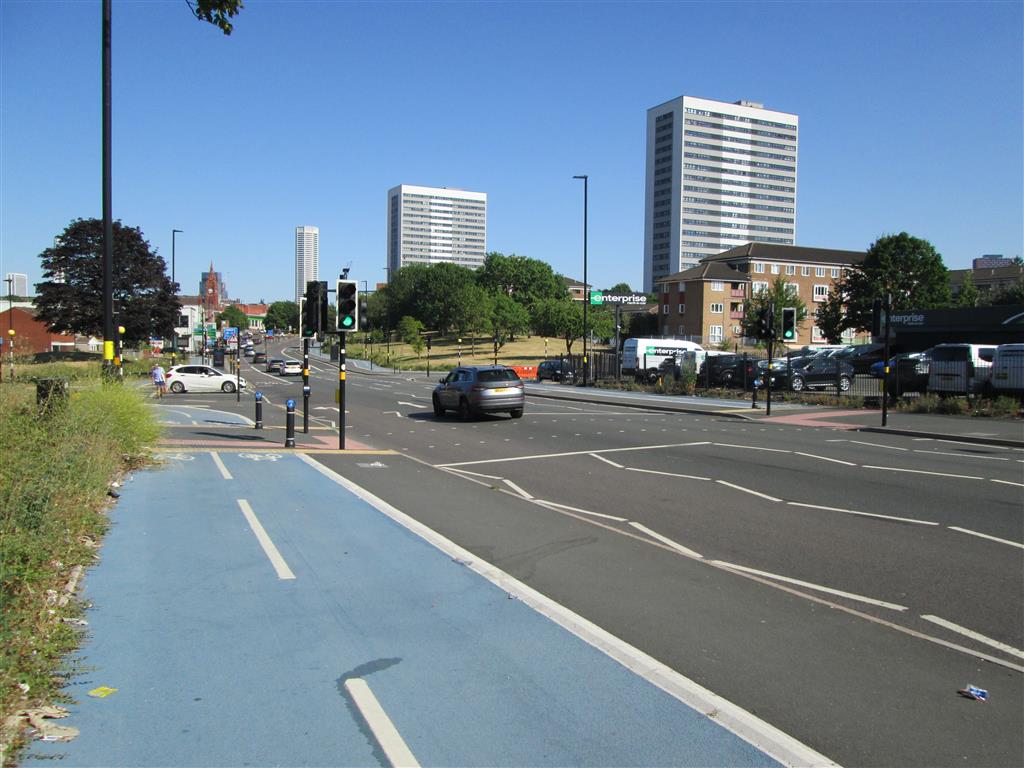
Junction of Western Road and Dudley Road
Junction of Western Road and Dudley Road
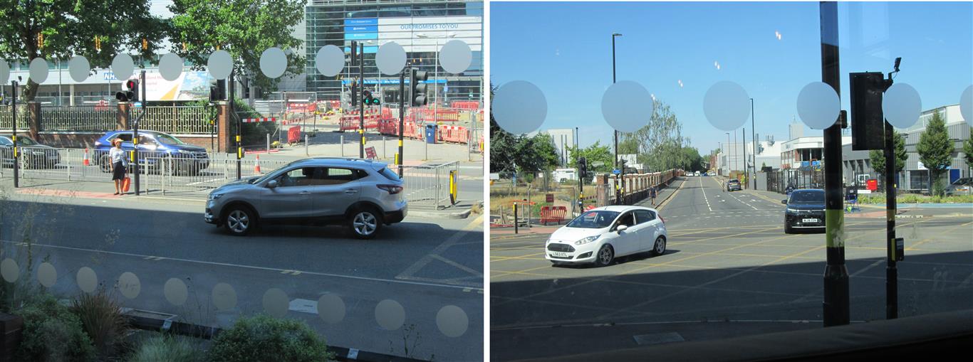
The cycleway on the far side of Dudley Road crosses Western Road via a toucan crossing, but construction of the cycleway outside the hospital has yet to be completed. This junction in general is very poorly implemented, and shows what happens when desperation to keep motor traffic flowing smoothly takes precedence over everything. The left-most lane (from the opposite perspective) has a double arrow head that allows turning both left and right, but not straight on. However, that didn't stop people from going straight on, and I don't think it is intended that straight on should be disallowed. Worse still, when drivers in that lane take advantage of the arrow in order to turn right, they find themselves coming into conflict with traffic in the conventional right-turn lane, because the exit is too narrow to allow a "lazy turn" (such as the driver of the white car is making, like almost every other driver), but there are no lane markings to guide drivers through the junction on a tighter radius so that they have completed the turn before they get to the traffic island. Note how the grey SUV (that made a "lazy turn" from the conventional right-turn lane) is effectively occupying the entire carriageway, a situation that only gets worse when the vehicle is a truck. I did see one driver making the turn as it should be made, but only one, and that driver was in the left-hand lane so it didn't have any benefit. So most drivers ended up trying to merge at the exit from the junction when a conflict occurred. Fortunately very few drivers tried to turn right from the left-hand lane, minimising the opportunities for a collision. It's worth adding that in the Netherlands roads are designed so that even if you are encountering a junction for the first time, it will be obvious which lane you should be in because all junctions have the same lane arrangement.

Tags: 

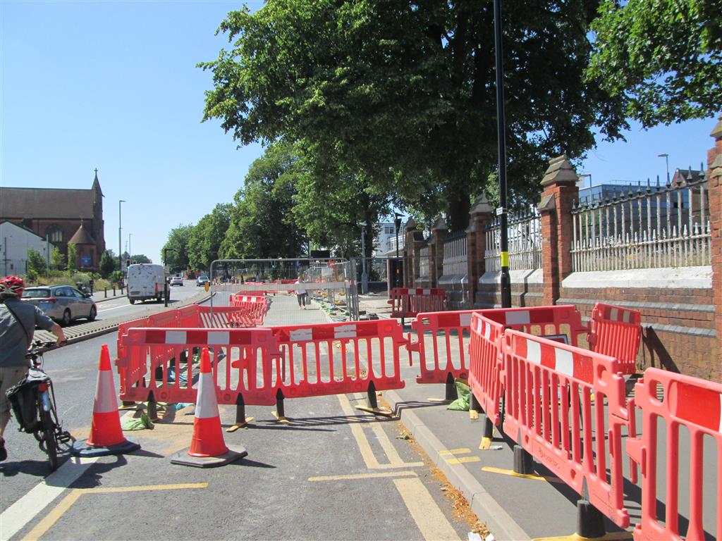
Dudley Road Outside Hospital

Dudley Road Outside Hospital
The cycleway, when it is complete, will be just the other side of the brick wall on the right. Unfortunately we had to deal with this unnecessary obstacle course on the Saturday afternoon I was first there. People were opting to walk in the live traffic lane to get past it, and fortunately drivers were being considerate. I can confidently say "unnecessary", because when I returned on the following Wednesday evening, the state of works hadn't changed but a pedestrian walkway had been opened up along the closed motor traffic lane. In fact not only was there a pedestrian walkway, there was a ramp up the kerb at either end for those of us with wheels. When Push Bikes visited the Netherlands we found that much effort was put into providing safe and convenient temporary routes during construction work.

Tags: 

Off and On Cycling on the Dudley Road
Off and On Cycling on the Dudley Road
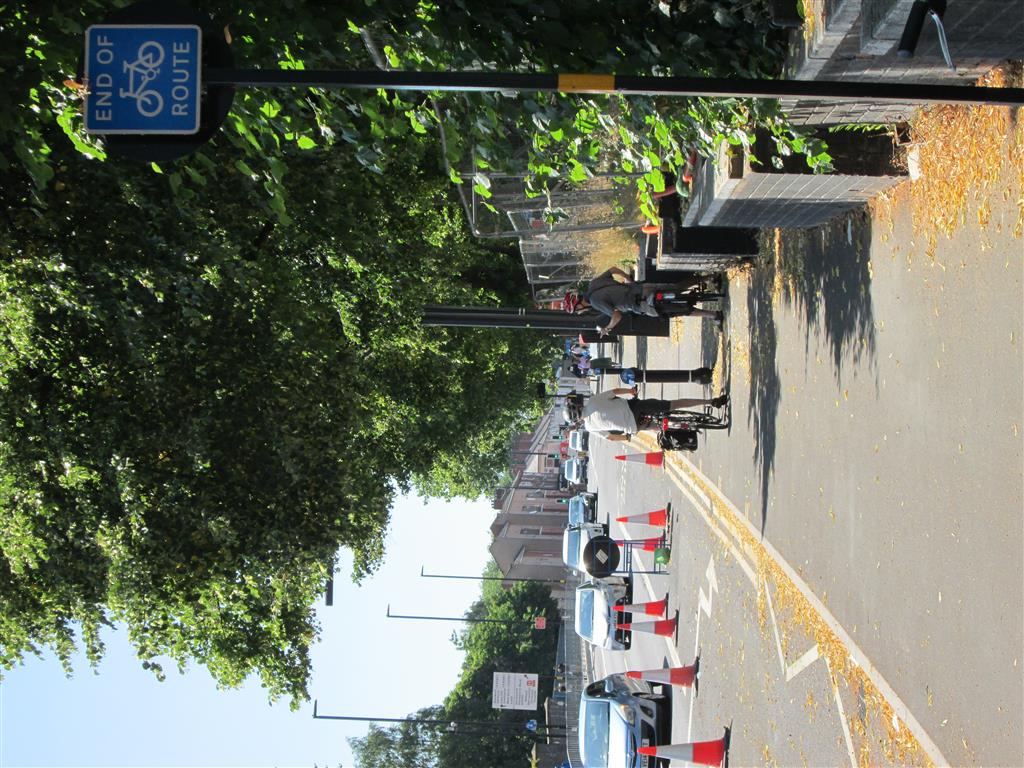
Once past the obstacle course outside the hospital we came across an END OF ROUTE sign and almost immediately after it a bollard with a shared use sign. I've seen similar a few times in Birmingham. The first sign has been erected because there is a toucan crossing behind the viewpoint (built in 2024 as far as I can tell), and presumably people using it as a cycle crossing were only allowed to turn right once they had crossed to the north side. The bollard appears to be new. I guess the END OF ROUTE sign has been forgotten.

Tags: 

Dudley Road Junction with Aberdeen Street
Dudley Road Junction with Aberdeen Street
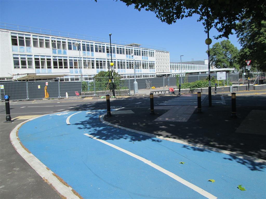
Once across Aberdeen Street we can look back at where the as yet uncompleted section of cycleway will emerge. Just like at College Street, this is a well-implemented side-by-side crossing.

Tags: 

Aberdeen Street to Heath Street Shared-Use Pavement
Aberdeen Street to Heath Street Shared-Use Pavement
Between Aberdeen Street and Heath Street there is a short length of shared-use pavement. I understand why this has been done; there's limited available width and there's a bus stop here. However, the reason why there is limited available width is because the city council would rather have a four lane road through a local centre than reduce the number of lanes, which will result in traffic evaporation and provide more space for pedestrians and cyclists. The better environment that results from traffic reduction is proven to increase trade in local centres. Having four lanes does allow there to be a bus lane, but that bus lane is not a 24 hour bus lane (as Push Bikes pushed for), so its benefits (which include increasing the separation between people engaging in active travel and the noise, stench, and danger associated with large numbers of private cars) disappear out-of-hours and the lane fills up with private cars. And if that were not incentive enough to take the route of traffic reduction, right under this point the bridge arch has a large crack in it and is threatening to collapse. So whilst from a cycling perspective it's not terrible, the decisions made here are.

Tags: 

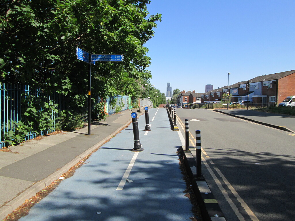
Good Signage at Heath Street

Good Signage at Heath Street
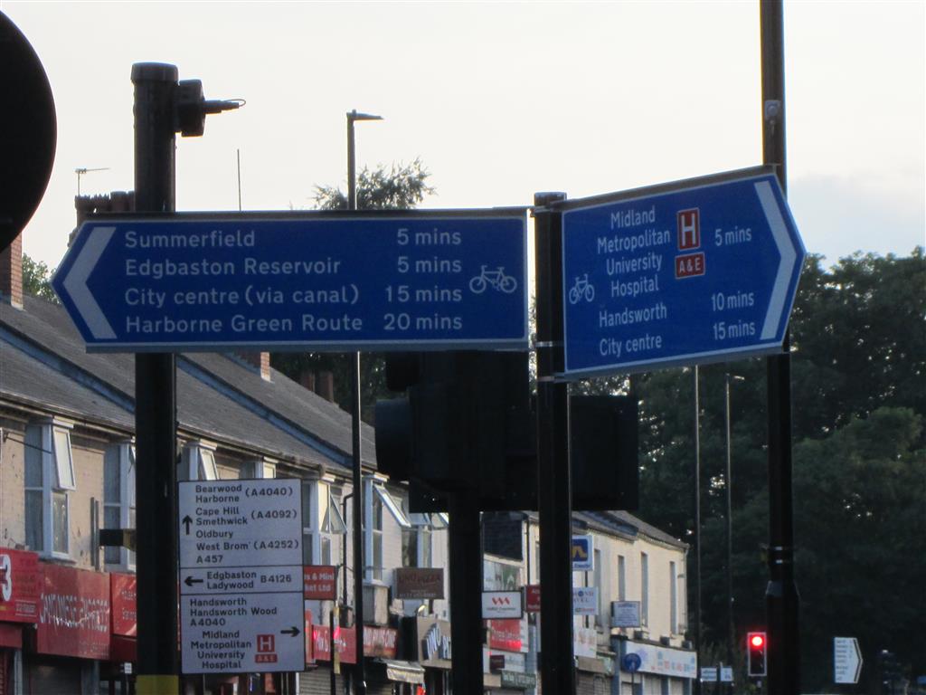
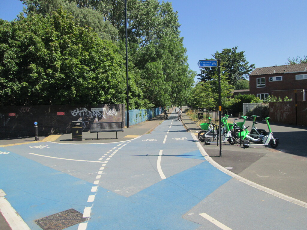
Unlike everywhere else in Birmingham the signage on this route is good. I "asked the family" (and I'm the only one that lives in the West Midlands) if they could work out where I was when I took this photo, and my brother quickly came back with the correct answer (not fooled by the long focal length I used). For me that is an indicator of good signage. I like that the signs list both nearby destinations, and local centres further away by their commonly used names. My only criticism is that they given journey times rather than distances (preferably in metric, which is simpler and more fine-grained than old-skool units). Who was riding the bike when they came up with the times? What sort of bike were they riding? Did they just assume that all bikes go at a certain average speed and work it out that way, in which case did they make allowances for hillage over all or part of the journey? If they did make that allowance, shouldn't they have one time for an e-bike and one for an acoustic bike? Did they allow for time spent waiting at junctions? The list of questions is endless, and simply using distances rather than journey times eliminates that list. But at least I know where the cycleway will take me.

Tags: 

Dudley Road Where It All Goes Badly Wrong
Dudley Road Where It All Goes Badly Wrong
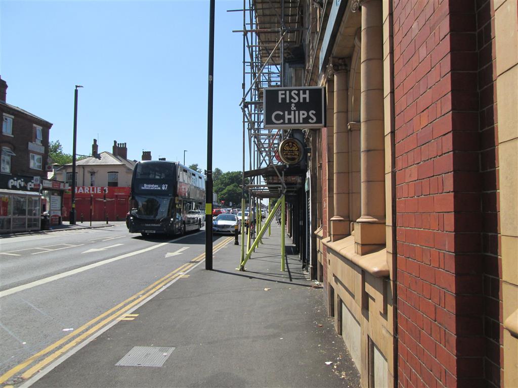
Oh dear. Whilst Section 6.1.9 of LTN 1/20 states, "Creating space for cycling may require the reallocation of space within the highway boundary. Wherever possible, this should be achieved by reallocating carriageway space, not reducing the level of service for pedestrians.", here the city council has done the opposite. So this is what faces people cycling along the Dudley Road once they get past Heath Street (and yes, this is part of the development area). People walking and on cycles are expected to share the pavement outside shop doors so that the council can have four lanes of the motor traffic that it loves so much. The bus lane is not 24 hour, and out-of-hours people are allowed to park here. Half a dozen cars, most of which will be people visiting other shops or no shop at all is not trade. It represents a business on the edge of collapse. Yet rather than giving businesses what they need, the council caves and gives them what they ask for. If the council had done the same in New Street, New Street would still be rammed with cars and the shops would not have seen the 25% increase in trade that followed its pedestrianisation. People in cars bring almost no trade. Even if the driver wants to stop and shop, the fundamental lack of space means they probably wont be able to. Studies have shown that a large proportion of motor traffic in an area is caused by drivers driving around looking for somewhere to park. When they do find somewhere, they hold up all the other traffic whilst they shunt into the parking space, adding to the congestion that discourages people from going there in the first place, because it makes the area difficult and unpleasant to visit. Yet there is off-street parking available in the immediate area (in Barford Road, and free customer parking at Lidl), along with on-street parking in side roads. Businesses will scream for more parking, but where? Whose house or business do they want to demolish to make space for what is a very spatially inefficient form of transport? On the other hand pedestrians just walk through the door of any shop that takes their fancy; I've done that myself whilst walking, discovering useful shops that I would have driven straight past. People on bikes do need somewhere to lock up, but that takes up far less space than car parking and there is never any need to cycle round and round an area to find somewhere you can leave your bike. Shop owners in Germany frequently provide bike parking in front of their shops, because they know where their trade really comes from. Birmingham city council has opted here for old-skool tried-and-failed rubbish.

Tags: 

Heath Street

Heath Street
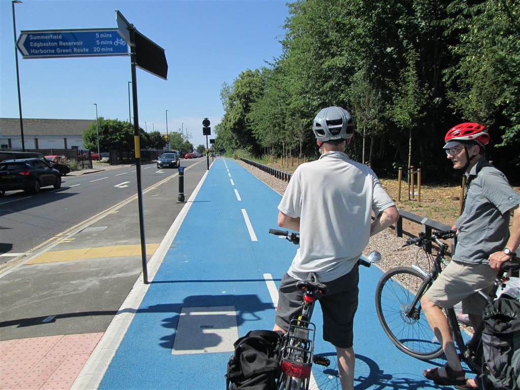
It's possible the city council feels it's OK to create a pig's ear beyond Heath Street on the Dudley Road because they've provided a very good if lengthy detour via Heath Street and Winson Green Road, but not only is that a detour (making it contrary to the DfT guidance in LTN 1/20), it takes people away from the shops on Dudley Road. But hey, judged on its own merits, this is a good length of cycleway that hopefully will be extended in the future.

Tags: 

Division Line Detail

Division Line Detail
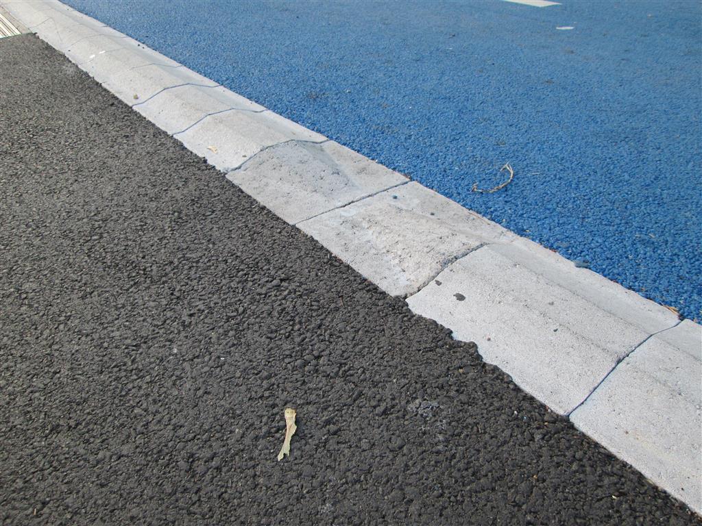
Much use is made of raised division lines. These provide clear, tactile delineation between cycleway and footway when they are at the same level. They are designed such that a cycle wheel, even a small wheel, can pass over them at a shallow angle without dismounting the rider. They also have regular gaps to provide drainage, as shown in the photo. This is great attention to detail, and gets a ten out of ten from me.

Tags: 

Cuthbert Road Junction

Cuthbert Road Junction
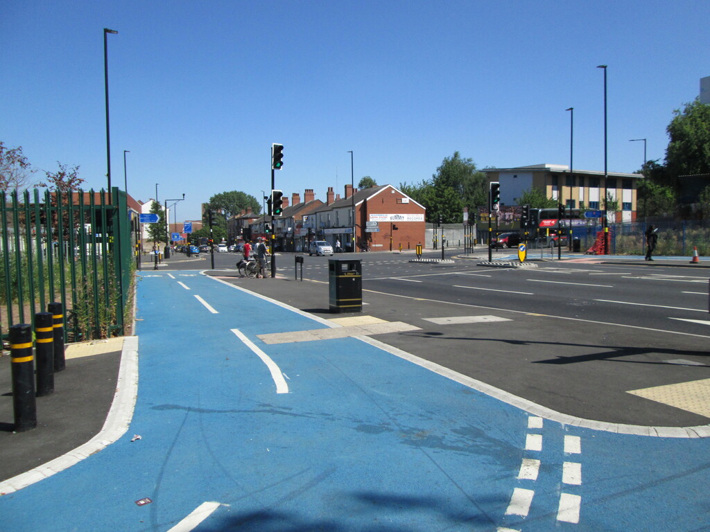
A two-stage toucan crossing connects the cycleway on Heath Street to that on Winson Green Road, but if you're quick you can do both stages in one go (it works better in the direction of Heath Street), which is nice, but it's a pity the timing is so tight. Filtered permeability has been provided into Cuthbert Road.

Tags: 

Junction of Winson Green Road and Dudley Road
Junction of Winson Green Road and Dudley Road
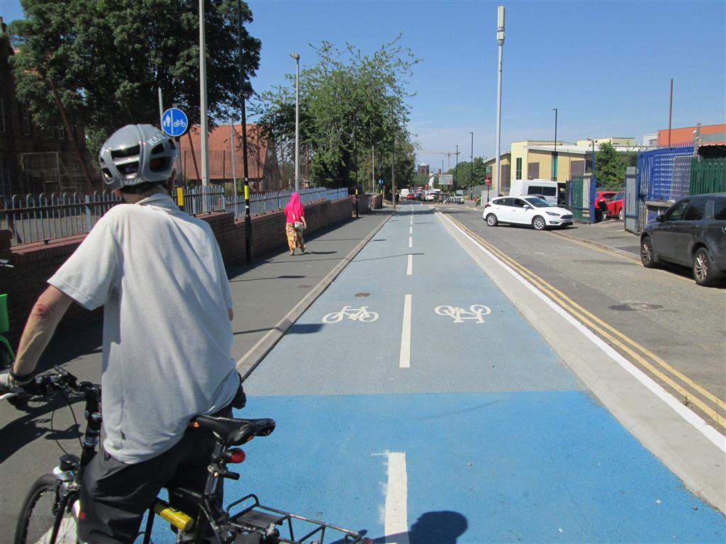
A short distance from Cuthbert Road the cycleway departs the main carriageway of Winson Green Road and joins what looks like what was once one arm of a triangular traffic island. However, as far back as at least 2008 it provided no through-route for motor traffic, and it has now been partially turned into a cycleway.

Tags: 

End of Dudley Road Route

End of Dudley Road Route
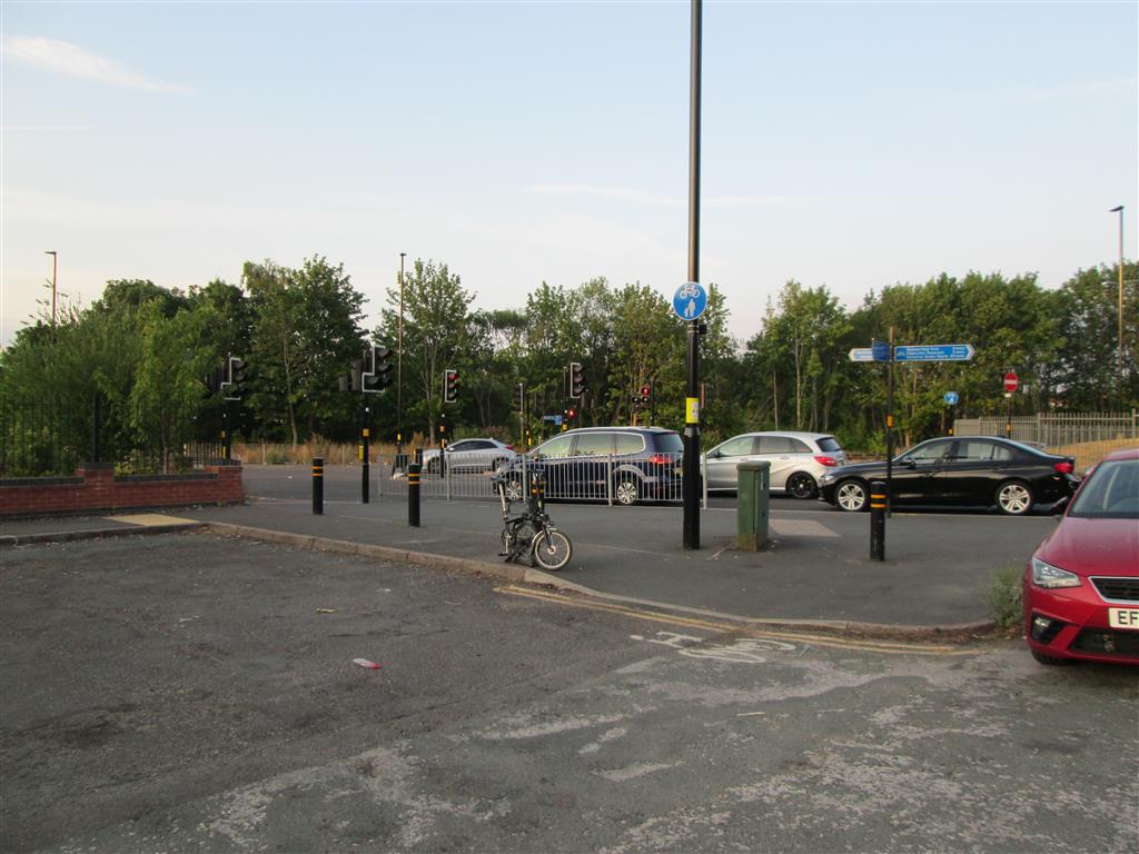
This is as far as the Dudley Road cycleway goes. From here you can follow the shared-use section back to Heath Street, go down Winson Green Road on the cycleway, or cross the road. Crossing the road allows you to get to Summerfield Park, but that will only take you a little further off-road out of the city along Dudley Road. Hopefully that will change.

Tags: 

Dudley Road Junction with Northbrook Street
Dudley Road Junction with Northbrook Street
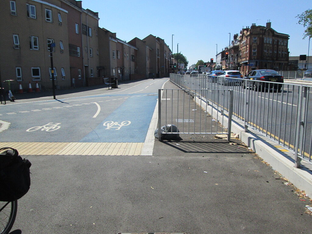
If you use the toucan crossing to cross the Dudley Road at Heath Street you meet this short length of cycleway, which is primarily for accessing Northbrook Street, but also gives access to some shared-use pavement behind this viewpoint. Whilst useful, the design creates a useless wedge of footway between the fence and the cycleway, a wedge that has been blocked at the wide end by a stub of fence. Presumably this is to stop people from walking along the wedge, but its effect in practice is to force pedestrians into the cycleway (which they do suddenly and without looking up from their smartphones). To my way of thinking it would have been better if the cycleway followed the fence closely right up to this point, which would avoid the wasted space of the wedge and eliminate the need for the stub of fence that just creates a problem.

Tags: 

Top of Northbrook Street

Top of Northbrook Street
The short section of cycleway on Dudley Road opposite Heath Street leads mainly down Northbrook Street, which has been given a delightful filtered permeability treatment. The tree cover afforded by this micro-park is most welcome in an area that otherwise lacks it. Tree cover is going to be increasingly important as anthropomorphic climate change bites ever deeper, and building four lane highways is only going to increase the heat island effect in urban centres. Alas it is likely the main reason for the filtered permeability is because there is a large crack in the underside of the canal bridge here, putting it at high risk of collapse if the motor traffic isn't reduced. That would be another reason for not having a four lane highway through this urban centre.

Tags: 

Start of Harborne Green Route

Start of Harborne Green Route
Harborne Walkway appears to have been renamed Harborne Green Route, presumably to make it more inclusive. It starts half way down Northbrook Street, where a gap has been placed in the cycleway and a new section of path has been built (on the opposite side of the road) to make it easier to join the green route. If you look very carefully, you may be able to see small silvery domes on the top side of the divider. Their intended purpose is unknown to me, but maybe they reflect headlights. If you know, please tell us!

Tags: 

Northbrook Street Canal Access

Northbrook Street Canal Access
At the end of the Northbrook Street cycleway there is access to the canal, but whilst it has a wheeling ramp, it is steep, tight, and difficult to use. It's worth remembering that this used to be where a railway crossed the canal, so there is plenty of space to build a proper ramp. Alternatively, maybe a connection could be made at Loverose Lane (I wonder who Rose was). Whilst these steps are convenient for the green way, if you quite understandably find heaving your bike up and down them difficult, the canal access at Clissold Passage will be worth the detour.

Tags: